Dome Rock, Dome Rock Wildlife Area, Divide Colorado, Nov 17, 2007
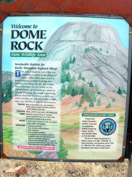
- Welcome Sign
“237 feet” …I mutter looking at my GPS as I slowly munch on my ham and cheese sandwich perched high on the side of Dome Rock
“237 feet more vertical?” Tom asks
“No, only 237 feet to the actual summit…”
“You have got to be kidding me. We came 4.2 miles to not go the last 237 feet?”
“Yeah”
Now even Tom is disgusted…
We both get up from the ledge and examine what lies above us for the third time. We are separated from a doable cleft in the rock by about 15 feet of steeply sloped friction pitch that is best, 4th class in difficulty. But below that 4th class pitch is a potentially fatal fall should you slip. Plus the old adage is that it is easier to go up then come down is …well…it’s true. Lunch still seemed like the best option…
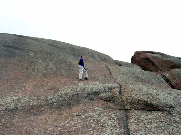
Tom examining the options…let’s just eat lunch
——————————————————————————–
We had started the morning at about 8:45am after a short drive up from Colorado Springs to the trailhead in the Dome Rock Wildlife Area between Divide and Cripple Creek. We had been talking about doing this hike for some time, but had been spurred on by very good trip report posted on Summit Post where a gentleman had ascended from the west the previous Sunday. Unfortunately, in that approach, he had to cross private property and we did not want to do that so we agreed upon the traditional eastern approach along Four Mile Creek. It is a good thing we decided to do it on Nov 17th as on Nov 30th it is closed until Jul 15th, 2008 due to the wintering and lambing season for big horn sheep!
As we started down the trail we anticipated a beautiful Colorado blue sky day with warm temperatures. While it did grow warm, perhaps for the last weekend before winter, mid-level clouds drifted in making our picture taking day less than ideal. I say “started down the trail” because the wide and well used trail descends with Four Mile Creek as it plunges from pool to waterfall for the next 4 miles. All of the elevation gain we lost in the first 2 miles is uphill at the finish.
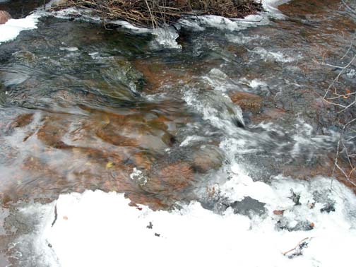
Five minutes into the hike, we come across 3 guys with 3 big guns. My first thought is that they are all in some type of gang as they are all wearing “colors” and I instinctively reach for my Sigg 229. Of course I am not carrying it and Tom explains to me that the “colors” are the bright orange garb required of licensed hunters. I choke on the question I wanted to ask (Is it legal to hunt here?) and instead wish them the best and ask them not to shoot us. The rest of the trip for me was scanning the cliffs ahead for any signs of other hunters and making lots of noise with Tom. Thirty minutes later, we are walking above a large section of ice in a beaver dam flooded hollow and a sharp crack rings out. My first thought was that a bullet just passed by, but instead, Tom says it was the ice cracking just at the time we passed above it. Whew… close call!
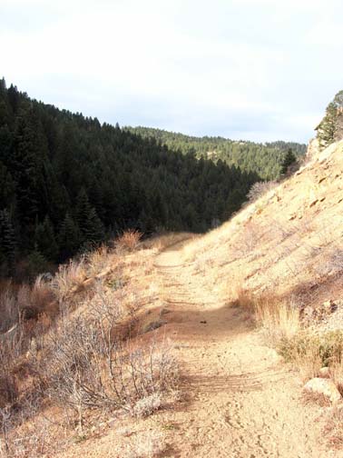
A nice path when you could follow it…
I would describe this trail as an excellent, mostly flat trail that winds along the creek and down through the valley to the area at the base of Dome Rock. It would be a GREAT trail to hike; unfortunately you cannot do that unless you bring sandals and hike it in the summer. It crosses the creek about 22 times and the only bridge is at the first crossing! It was running about two feet deep Saturday and when hiking in winter, you just cannot get your feet wet in the first 500 yards for a 5 hour outing. What has resulted over the years is a climber’s trail that follows the canyon wall. Each time the trail crosses the creek a smaller trail takes off on the right side of canyon, bypassing the water. When in doubt, stay right – all the way! Like any climbers trail, it always seems like you are walking twice the distance up and down out of side gullies, winding through the brush and around the creek. Two thirds of the ways up the canyon; we encountered the remains of the lodge that once occupied the spot overlooking a wider section of the canyon. Here is where we encountered the sign about the closure on Nov 30th for the sheep.

Old oven
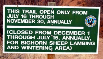
Closed for the sheep soon
Just past the lodge we catch what we think is our first glimpse of Dome Rock. Later it turns out to be another nubbin across the “Yosemite like” valley of Dome Rock. Breaking out in the wider valley the real Dome Rock reveals itself. Then unfortunately, we both agree that neither really remembers which route to approach on. A steeply north facing forested hillside across the creek seems like the best route to a saddle and then south to the base of the Dome. Willows separate us from the river and the hillside so Tom leads the way as we thrash our way through these bushes. For anyone who has bush whacked through willows you know that 10 feet can seem like a mile as the limbs grab at your clothes and prevent forward progress. We fall out the other side of the thicket and find a place to ford the creek, now entering the willows on the opposite bank! By the time we reach the hillside proper we are properly banged and scratched up.
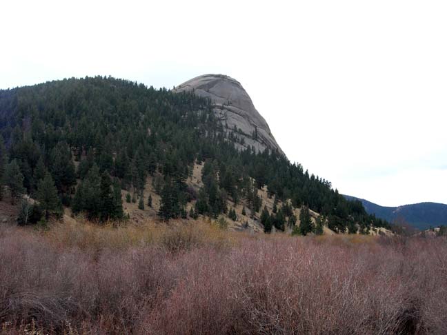
Dome Rock
The steep hillside is covered in clumps of grass and scree, but slow steady progress allows us to gain elevation. After about 200 feet Tom and I pause to shed a layer and it is at this stop that Tom’s camera comes off his pack hip belt. That would not be discovered for another 200 feet and 10 minutes later though. Tom, eyeing the descent, opts to retrieve the camera on our way down by following our GPS “breadcrumb” trail. We continue steady progress upward until we reach the saddle at the base of the rock. I had actually thought the route up would around on the eastern side, but that side is almost sheer. Tom leads the way to the base of the rock where we ascend an additional 200 feet to the ledge where this story started. We place our packs on the ledge and scamper up to examine what lies ahead.
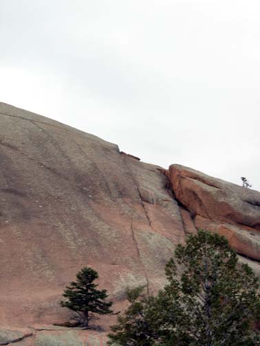
The route near the slab overhang
Tom is surer of the route than I and he edges across the base of the friction pitch to a crack system where he gives it a go, only to retreat when he did not feel comfortable with the options in case he slipped. I walked to the base of the friction pitch and decided that a simple 4th class section is really 5.10 in difficulty when the consequences are a 200 foot fall. Seems like a good time to have lunch and call it a victory… until I look at the GPS which brings us back to the present…237 feet…
——————————————————————————–
With the ham sandwich building courage in my gut, I at least put my hands on the friction pitch and go up on one step. Tom is quietly giving encouragement and motivation as I explore options. “Come on Bob, we never take risks” is one quote from below me as I test the waters.
I know I can easily go up without fear of falling as long as I kept my momentum; it was the getting down that had me concerned. I did not like the thought of sliding down on my rear or crab walking at this angle with the exposure below. I took another step, keeping three points of friction at all times. I was now within 5 feet of reaching a sloping 20 degree section where I could traverse over to the crack which I presumed led to the summit. I decided while I did not really want to get stuck on the rock I was only 227′ to go so I made the combination move to the 20 degree section and quickly sidestepped over to the crack system. Tom and I discussed options now that I am above him and I offer that I will continue up to see if it opens a route to the summit before he tries to come up. The next challenge is a left dihedral crack with some grippy face holds for the boots and I get up to the wider section where I can actually get “inside the crack” and scamper up the last 30 feet to the summit. On top! Tom yells at me to go all the way to the summit so I walk up the lesser slopes to the actual summit, touch the top, and return to the top of the crack.
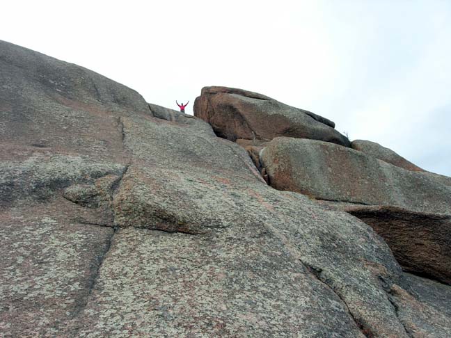
On top!
Tom bypasses the friction pitch and gives the crack another try, but does not feel comfortable. I descend down the wider crack to a location just above where Tom stopped. After a bit of conversation Tom gives it a third tries and joins me on the face. I then repeat the climb up the wider crack back to the summit. There is a tricky move on that portion and Tom is undecided, so I climb back down to offer spotting and encouragement. He makes it up that section in great form and I rest in the crack, breathing like a locomotive.
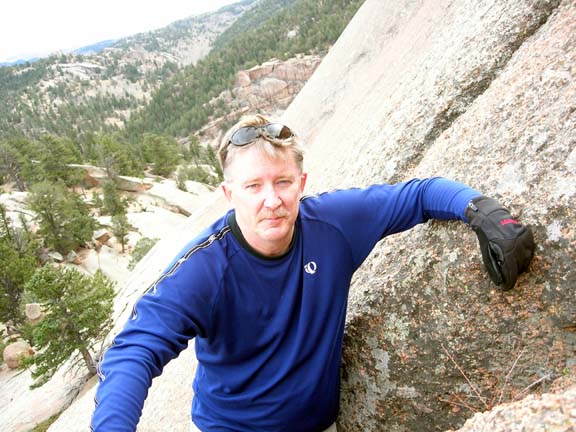
Tom at the first crack. Friction pitch behind him
I now have the camera in my pocket below him and Tom is insistent I join him on the summit (my third time). Finally we are both on the summit together! It reminds me of being on George Washington’s head on Mount Rushmore on a VIP hike I once took, compliments of the USPS. Each side slopes off rather dramatically!
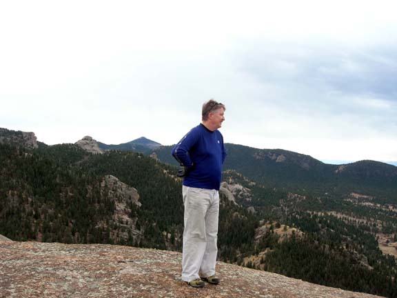
Tom on top!
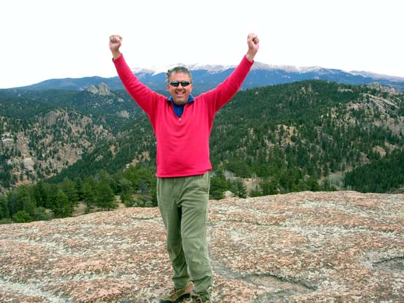
Bob on top!
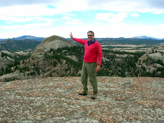
Bob pushing the rock
I am always somewhat uneasy when I am on a summit where the retreat is unknown, so as usual, I did not want to spend much time on top and after some pictures, started to head down. Sorry Tom, I’ll get over that sometime. We both made it down the two sections of the crack and walked across the bottom of the slope at the base of the friction pitch to our ledge and packs! Reaching those packs felt good!
After a successful summit, we packed up and decide to go find a camera. Following Tom’s GPS, we retrace our steps and exactly where he though he dropped it, we find it lying on the hillside. The GPS just earned $150 with that camera recovery! Approaching from high ground, we pick a better traverse through the willows and back across the creek. Only 4.2 miles to go back to the Xterra! EEK!
4.2 miles on a climbers trail is…well…long and we arrive back at the trailhead toasty. In the last 1/4 mile we passed a group of 4 senior adults from Texas mining for gold…I kid you not. We were happy with this hike and although as we were sitting at the base of Dome Rock we both agreed this would be the only time in my life we might be there, I may bring my daughter back in the summer as she is the rock climber in the family!
All pictures at: http://whitespider.smugmug.com/gallery/3858589#223400454
And Tom’s pictures and comments at: ttp://vervaeke.smugmug.com/gallery/3858719#223407215
Beta: 8.59 miles RT, 5.18 hours, 605 feet elevation gain
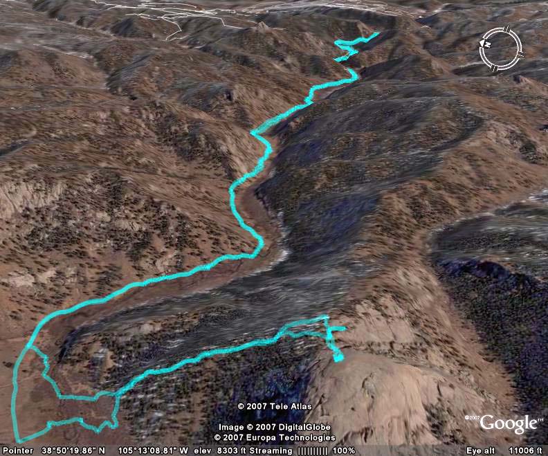
The entire hike
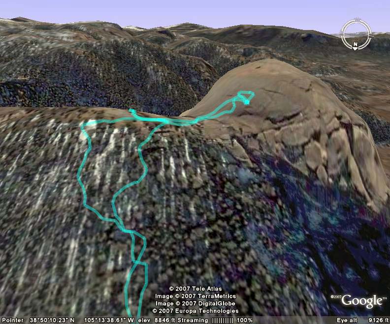
The final ascent to where we stopped on the ledge


