
Tom..
Everyone makes lists… whether they are lists in your planner at work, your electronic PDA, or stuck on the refrigerator or the dash of your car… everyone makes lists. I am no different, but my lists are a bit “different” then most. My lists include states, mountains, motorcycle challenges and miles to ride. I don’t really know why I make it so hard on myself coming up with new lists of things to do that challenge the mind, body, and character. And I have no idea how I actually rope friends into some of these whacky ideas… but they keep coming. Maybe Harry is next for the 48 states in 2008?
This whacky idea was an ambitious one…combine a high mileage day (617 miles) on the motorcycle riding through 4 states (CO, NM, TX, and OK) with reaching the summit of the Oklahoma state high point, Black Mesa at 4,973 feet, via a 8.4 mile roundtrip hike. Normally you would want to do this treeless, hot hike in the early am or in the spring or fall. But on Saturday we would be hiking it in 90 degree temperatures starting at about 1115 in the morning. Who could I get to join me as an endeavor like this that is best done with a partner?
Luckily I have a longtime friend that is a much more accomplished motorcyclist than I and also an accomplished hiker and climber, Tom Vervaeke. I ran the idea by him initially about 10 days out and let the idea germinate. He did some quick route analysis and suggested that in order to do it in a day; we would leave early at 0600 and would be back by 2000 or 2100 at night. We then both agreed we it was doable about 4 days out and I suggested we think about it for another two days and if we both still agreed, we go for it.
Nothing changed our thinking on Thursday so on Saturday at 0600 we met at the gas station in Colorado Springs in total darkness at 0545 at a chilly 48 degrees. Tom was on his ST1300 and me on my GL1800. On board we carried water, snacks for the ride and the hike and our hiking gear (packs, shoes, hats). Our plan was to motor south on I-25 over RatonPass to Raton, New Mexico.
After getting on the road, I pulled into a rest stop about 30 miles south as dawn was breaking to grab my camera from my trunk and we swapped leads through Pueblo, Walsenburg, and Trinidad, Colorado. My radar detector showed one instant on laser hit from a local Pueblo PD officer and one KA hit by a state trooper farther south, but the speed limit here is 75 mph, plenty fast enough to cover ground while not wasting gas mileage at higher speeds.

It was pitch dark when we started at 0600, but 30 mins later dawn was breaking…Tom on his ST
Gassing up in Raton, we left the interstate behind for the day and continued easterly on Route 87 to Clayton where we picked up Route 412/56 heading to Boise City, Oklahoma. We neared the tri point where Texas ,New Mexico , and Oklahoma all meet on a gravel country road. Tom pulled over so I could go down the road a bit, adding Texas to the states I have ridden in. Back on the road toward Boise City, we were lit up by a country sheriff on KA band heading west, but he appeared to be on another mission that day and we just waved at him. Riding through a grouping of buildings called Felt, Oklahoma, we knew the destination was due north from this point, but we had to go farther east to pick up a paved road. Slowing down for Felt with Tom in the lead we passed a road on our GPS which we assumed was gravel, but saw blacktop. We did a U turn on the highway and turned north on NO130 road, stopping to talk with a women mowing the grass to verify the road was paved all the way to Kenton, Oklahoma.
Indeed it was paved and we made good time heading due north on a beeline. The road was spotted with numerous cow pies its entire length and on two occasions we encountered a cow and calf on the wrong side of the fence grazing along the road. It might as well have been open rangeland at that point. Soon we intersected the road coming west from Boise City we had originally planned on taking and continued north where the road actually started curving and dipping down through canyons and mesas.
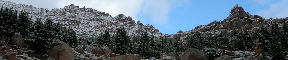
Right before Kenton, I led us on a right hand turned on an unmarked road that had a sign that said “Colorado” to the Black Mesa trailhead. Due to the shortcut we had found at Felt, we arrive at the gravel trailhead at about 1015. There were two cars in the small parking lot and we pulled to the left and parked on the prairie itself. The temperature when we stopped was 88 degrees, a full 40 degrees warmer than when we started.

Parked our bikes on the prairie at the trailhead (frame grab from video)
The first thing we notice after we dismount is there are locusts or grasshoppers all around and they are BIG, suitable for BBQing! They are jumping and flying all around and they must not have good on board navigation systems as they smack you in the leg, arm or chest at random.

Bigger than most jumbo shrimp…this guy is just a shell of his former self

Very nice trailhead with a ready to go Tom!
Now we switch from the motorcyclist mode to the hiker mode. Stripping off our riding gear, we stow it away and get out our hiking shoes, and packs preparing to get started on our 8.4 mile hike. The trailhead and the trail are well marked so we fast hike through the cactus commenting on how warm it is at 1045 already! The hike is essentially 3 miles of hiking across the flat high desert to the western edge of the Black Mesa and up about 700 feet elevation gain in a switch back ascent of the mesa over maybe a ½ mile and then once gaining the summit, another ¾ of a mile to the west to find the marker. We did this ascent in about 1.5 hours so it is evident we were hiking at a fast pace.

Also very well marked, about a mile in
Along the way we met a couple from Pennsylvania who had flown out to do the Texas, Oklahoma, and New Mexico high points on vacation. They both had Harley motorcycle shirts on and were riders back east. Although we never got close to them we spotted a group of college students from Rogers College, who were in white college SUV’s who must have entered through locked ranch gates to drive to the base of the mesa. The couple we met said they were a biology group looking for rattlesnakes.
As we approached the climb of the Black Mesa, we encountered ½ of the other party we knew was ahead of us. She was standing under a tree in a small pocket of shade in the steepest section resting. Her SO was ahead and she was not sure she was going to finish the ascent (200 yards) to the mesa plateau. She was ¾ of the way already but did not feel she could finish it off. After she assured us she was just fine, we continued up.
Once on top of the mesa we knew we had a ways to go to reach the actual summit so we put it into a high gear, gradually catching the ladies’ partner as we approached the obelisk. We slowed down a bit to let him have some solitude by himself at the top before we arrived and then we joined him taking pictures and enjoying the “view”.

3.8 miles of this trip in was mostly level up this valley then a sharp climb up the mesa was required
Wolfing down a sandwich and continuing to drink water we departed the top about 15 minutes after the gent. He had told us he was 74 years old! Both of us hoped we were still hiking at 74! We caught up with him just as he reached the spot where his SO was resting in the shade. We chatted for a bit and they assured us they were fine and had lots of water so we continued our descent to the desert below. Tom quicken an already fast pace and we made it good time while keeping a sharp eye out for snakes. We encountered cattle on the open range and they seemed to be making their way west to a distant stock tank for water. Locust continued to ram us from all direction.

Obligatory “summit” shot of Tom (blue) and me (white)

Obligatory “summit” shot of Tom (blue) and me (white)

Cows were everywhere as were their trademark cow pies…
Arriving back at the trailhead, we found our bikes still standing on the hard packed prairie, but now we were faced with putting all of our riding gear back on in the middle of a desert in the max heat of the day. Tom pulled his helmet from a saddle bag and commented that it felt like it had been sitting in an easy bake oven for the last three hours. We did not waste time stowing our gear and headed quickly back to Kenton to get something to eat and drink at the General Store.
As we pulled up to the famous Mercantile Store we saw it was CLOSED! Oh my…
Tom found a coke machine off the porch so we coaxed the machine into spitting out two sprites and pulled a couple of chairs up to sit on the porch in the shade. A lazy old dog we would later find out was named “Harley” joined us for a nap. I could have stayed there for the rest of the day!

My favorite picture…we found the Kenton OK Mercantile store closed so we sat on porch and drank a cool pop (I owe Tom $1.00)
After about 15 minutes a gentleman arrives and he sort of resembles Santa Claus with a white beard. He said he used to own this store the last 15 years, but recently sold it to another gentleman who lived “out back”. We went around the side and opened the building for us to see the inside. He tried to convince us to head west from the store but there was 27 miles of gravel road over a mountain range that way so we kept with our original plan and headed east to Boise City on pavement.
Tom knows the roads in Colorado much better than I and he knew our route should be north through Springfield, Colorado to Lamar. After grabbing some gas in Springfield we headed north and ran smack into a one lane closure forcing alternate turns with a flagman and pilot vehicle. We dismounted and waited about 10 minutes for our turn. I estimated the lane closure was at least 5 miles long so we had timed it pretty good only to be held up 10 minutes. After passing a large energy wind farm, we arrived in Lamar. Before Lamar we faced the challenge of getting by about 40 cars and trucks that had been held up with the construction. It was an effort and early on I watched Tom pass about 6 vehicles safely and I was never able to close that gap safely in the passing zones that were open to me, so as I entered Lamar, Tom was waiting on me at the side of the road to continue on.

Unexpected one lane road with a pilot vehicle in the middle of nowhere

Waiting our turn
North out of Lamar, we encountered more traffic and had many passing challenges to keep a spirited, but safe pace. That kind of riding takes it out of you and I was pretty bushed after an hour or so of it when we arrived at an unmanned gas station in Kit Carson, Colorado. Filling up for the final 2 hours, we headed northwest until we came to route 94, which was a straight shot west into Colorado Springs.
We made good time on this deserted road all the way back to Colorado Springs. Tom tried to get my attention by honking his feeble ST horn to take the right country road shortcut, but I did not hear him and continued straight pulling over when I saw his headlight disappear. He rode up to me and told me about the shortcuts so I followed him for the last 5 miles as the sun was setting.

Tom catches up with me to show me the right shortcut
The dark clouds we had been watching for the last hour finally opened up right as darkness descended giving us a final challenge for the day. As the rain started in earnest, a northerly wind picked up and the temperature plummeted to 58 degrees, another 30 degree swing from 4 hours earlier. Only in Colorado! I arrived back at my house at 1927, some 13+ hours after we had departed.
This was a long day and the format which included riding 300 miles, jumping off and hiking 8.4 miles then jumping back on your motorcycle for another fast paced 300 miles left me feeling tuckered out. I had ridden through three new states and completed my 36th state highpoint. The only thing left for me to do was to clean the remnants of the cow pies kicked up in our wake off my riding boots.

GPS data for the day

The route