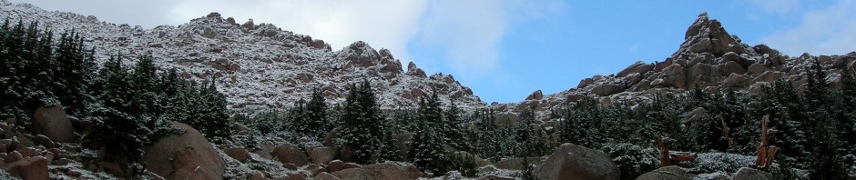

The Vista
Since arriving back in Virginia, I had been cycling a lot but had not picked up my pack since leaving Colorado in the summer of 2009. Today we changed that when Ben and I decided to get back on the horse and I picked a 3.9 mile round trip hike on the Appalachian Trail that ended at Mary’s Rock, a rock outcropping with advertised 360 degree vistas.
We got an early start of Fredericksburg and were at the trailhead ready to hike by 9:15am. The morning was cool and fresh with little humidity since the cold front had come through last Friday before the holiday weekend.
I had found this trail by looking at the Shenandoah National Park website and a great resource I just found at Every Trail … what a great site!

Trailhead

Moderately Difficult
We started up knowing we would be going straight up for the entire hike to the summit as it is a 1200’ elevation gain from the trailhead over 1.9 miles…i.e.: pretty steep. The morning was beautiful and the Appalachian trail great but rocky, Ben was trying out some new boots and I was simply enjoying the hike after 1 year off. Although I have 2000 cycling miles in this last year, every sport uses different muscles and my legs got a work out as we continued up the trail.

The Applachian Trail Blaze
There was one gentleman ahead who left about 10 minutes before us who said hiking was better than working and we only saw him again as we approached the summit.

Well marked
The Skyline Drive wound like a snake below us as we steadily climbed the trail. Since it was early we heard no traffic sounds as we climbed higher as our trailhead was where State Route 211 crosses the mountain crest before it drops down into Luray, VA.

Ducking under a tree
Time was NOT of an essence and I was not wearing my watch but assume we made it up in good order as we arrived at the rocky outcropping.

A hawk soared BELOW us on the thermal winds from the slope to the west. We lazed at the top, snacking and refilling our water bottles as we enjoyed the view in all directions. I was able to hit a repeater on my HAM radio (K0RWB) in Culpeper, VA, W4CUL, that I had talked on a net from my home over 60 miles away the night before. Obviously they have it up high on a mountain!

Ben on the summit

laying at the edge…
Beautiful weather, blue skies and views stretching 30+ miles…we enjoyed it all before we decided to retrace our steps down the trail. Coming up was a steady stream of prepared and unprepared hikers (individuals and families) that must have departed about between 1100 and noon, when we arrived back in the parking lot. We decided we would start hiking deeper inside the park and keep our early hour starts to avoid seeing many folks.
It felt great to get back on the trail and we are already planning on next, more challenging hike in a few weeks. I will attach the GPS track to this page in a few days.
Beta:
3.9 (RT) miles, moderately difficult, from Thornton ’s Gap