When I arrived in California most people were worried about El Nino, but I was concerned about La Nora, the hurricane that was battering the Baja coast when I touched down in Riverside California. The weather in California had been hot and dry; so dry in fact that the weather channel had said that Los Angeles had not had measurable rain in 259+ days. I had to smile as I boarded the plane for home on Thursday morning in the pouring rain…but let’s talk about what happened in between the airplane arrival and departure.
After completing business in Riverside, I headed north on Tuesday afternoon along the western edge of the Mojave Desert. It quickly reminded me of Arizona where I lived for 3 years in the early 80’s. I had grown to love the desert, but could live without the 2 lane State Road 395 in heavy traffic. After about 3 hours heading north I arrived at Lone Pine. Since I was traveling light, I had no overnight gear so I checked into the Mt Whitney Motel. (Thanks to Patrick Watson of Austin, TX for the recommendation – it’s the cheapest in town)

Mt Whitney Hotel
I then headed down to the ranger station on Main Street to check trail conditions and weather for the next day. The trail was dry all of the way to the top. The weather was also stable with lows in the 20’s above 13,000’ and clear skies. The ranger asked me if I was prepared for snow and rain…. I guess that is a standard question to ask all hikers just to see what their response is, but I gently told him, yes, I had all of my gear.
I then headed up to the Whitney Portal trailhead to familiarize myself with it as it would be dark when I arrived the following morning. (a Steve Hunsader tip!) The 13 miles goes quickly and climbs 5,000’ to 8361’. I checked out the parking lot, the trailhead store and walked a few feet up the trail to get my bearings. The trailhead reminded me of Longs Peak trailhead because it was so massive and improved to support the large numbers of people.
Heading back to Lone Pine, I stopped at the IGA to get some bagels and cheese for the following day. I turned in about 9:00pm and set my alarm for 2:00am. I left the motel about 2:30am and reached the now familiar trailhead at about 3:00am. I sat in the car for about 10 mins getting my headlamp and gear in order and half waiting to see if there were any other early starters. Then I started up by the light of my Petzel headlamp, finding the trail, wide, and well-traveled, crossing first the North Fork of Lone Pine Creek and then Lone Pine Creek itself. Spilt logs made for easy crossings.
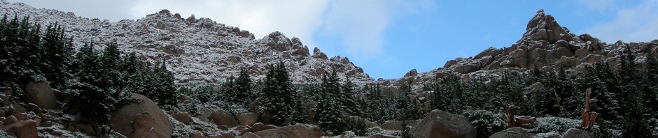
There are a couple of things I like about hiking at night… the miles seems to go by quickly, it’s cool, you can’t see how hard the trail is above you, and time just sort of drifts by like you are in a haze. I reached Outpost Camp, a broad meadow at 10,365’ in about 1.5 hours over 3.8 miles. My pace was quick and steady and I kept eating and drinking to keep it moving. I passed some campers in their tents who were just stirring at about 4:45am, but I kept moving, only briefing stopping to check out the magnificent solar toilets that the Forest Service had installed. They put the ones on Long’s Peak to shame. After the meadow, more switchbacks take you past Mirror Lake, which I could just make out in the dark, to tree line above. There was just the faintest hint of an orange glow to the eastern horizon and the half-moon was enough light above tree line to make out the path so I switched my headlamp off and continued up to Trailside Meadow at 5.3 miles.

Sun rise
I stopped to put the headlamp in my pack here as the dawn provided enough light to see clearly now. I refilled by water bottle and noticed that 1 liter was gone already and only 2 were left. I would obviously have to find water coming down. I continued up the rather interesting rocky trail up to Trail Camp (6.3 miles) arriving about 6:30am. All around were tents of overnighters who break the hike up into 2-3 day trips. They were mostly awake but I kept walking through the middle of their camp to the 96 switchbacks to Trailcrest. I found the first half of the switchbacks to be easy, while the 2nd half slowed me down a bit. I passed a party who had just left their overnight camp and caught a single guy who after talking with him as we hiked, was also doing the hike in a single day like myself. It appears there were only 3 day hikers going that day.
Brian was an electrician from coastal California and mainly a mountain biker but was on his vacation and wanted to end it with the summit of Whitney. He had started a full hour before me but had never hiked in the dark, so I think he was a bit slower than usual. I led up the switchbacks until after the steel cable portion and then he took the lead. At Trailcrest (13,777’) I was feeling tired, but had no altitude effects. After the saddle you have to lose about 300’ as you wind your way on the backside of the ridge, meeting the Muir Trail. The trail was quite fun and again reminded me of the narrows on Long’s Peak in Colorado.

Stunning to say the least with the morning sun
Finally coming around the pinnacles along the steep ridge you see the summit of Whitney, still about 1.5 miles and 500’ away. At about this point some guy in Lycra just carrying a water bottle ran by me…yes ran by me. He had started at 6:00am and was about to make the summit at 9:30am – unbelievable.
Brain and I hiked up the last 500’ together and arrived at the summit at 10:00am, 6.5 hours after I had started. A shot of GU energy paste allowed me to make it that final 500’!

Summit marker
I took some pictures and explored the east side that drops off sharply (let’s just say you could free fall parachute from the summit), and rested. I was down to 1 liter of water and knew I would be suffering until I crossed the ridge again, and descended the 96 switchbacks to Trail Camp where the last running stream was. I did not dally long and within 20 mins was headed back down the trail. As I was leaving, a fellow from Stuttgart Germany summited. We shared a few words about my time in Frankfurt and his time in Charleston, SC…small world. I would say that ½ of the hikers I passed while going down that day were from outside of the United States. I guess everyone wants to climb the highest mtn. in the 48 states when they come to America!
Retracing the trail along the ridge, Brian and I stayed within eyesight. I was suffering from early dehydration from water rationing of that last liter. I wanted to have some remaining for those 96 switchbacks going down. I reached Trailcrest to find about 6 guys taking a break on their way up. The tough thing about that last 2 miles that I had just returned from is that it is about all at 14,000’ – so it’s tough no matter how easy the trail. I didn’t hang around and started down the switchbacks, finding myself going faster downhill than I usually do.
Probably time to mention boots. I was wearing my lightweight Merell hikers and although adequate, I knew it would not be comfortable going down. The only pair of lightweight hikers I have found to be truly comfortable were by Vasque Clarion that I climbed 39 mtns one summer in… guess what I just ordered on the phone before I sat down to write this story? You guessed it, I was having toe problems in the front of the boots, but with 8.5 miles to go to the trailhead, there is nothing you can do but keep going. I caught Brian 1/3 of the way down and we strode into a now deserted trail camp (they were all still climbing to the summit) and down to the running snow melt stream. We rested, ate lunch and I filled two liter bottles from the stream and dropped iodine tablets in them. I did not have my filter and Iodine is a weak guard at best, but I needed water!
Usually you can shave time off downhill journeys, but not today. Brian was also having feet problems so our progress was about as fast as coming up. I stripped to shorts and a T-shirt and just kept walking into the increasing heat. We met many hikers coming up for the summit attempt on Thursday and I took advantage of their questions to stop and ease the pain of walking.
At least we were able to savor the beautiful scenery that we had missed in the dark; the towering rock walls, the waterfalls, the lakes, and the trees…. It just did not make the miles go any quicker. About 2 miles from the end I made the commitment not to stop; sometimes the best thing is to keep trucking and ease the pain by finishing quicker. I pulled ahead of Brian and reached the trailhead at 3:49p; 12 hours and 19 minutes after starting. 22+ miles is a long way and probably not a single day mileage climb I wish to repeat real soon. But there are some advantages I thought as I waited for Brian… you do not have to lug overnight gear up 8 miles and you are fresh when you leave the trailhead. Some of the climbers I passed just getting out of their tents did not look very fresh and moved quite slow on the trail as they were a bit tired from the previous day.
Brain came around the corner and we shook hands. I had reached by 2nd 14er in California this summer (not bad for a guy living in Illinois) and my 12th state high point. Brian was equally satisfied with obtaining his goal, but both our goal right now were to get into our Tevas and hobble to the car! I dropped him off at his campground site and continued down into Lone Pine. All that was left was the three hour drive back through the desert to Riverside. I did notice as I was driving south, the sky and suddenly become overcast and ½ home the wind picked up out of the east creating a sandstorm across 395. Hurricane Nora had turned east and was skimming southern California and into Arizona the next day. I wondered whether all of the people who were going to try and summit on Thursday would do so in rain or snow due to the weather. I got back to Riverside at the same time the raindrops started to fall.
It was still raining the next morning as I climbed the steps of the United Airlines flight home… it seems I had beat La Nora and El Nino by just a day!
Beta: 22 miles RT, 6,750 elevation gain, Class 1, strenuous, 12 hours, 19 minutes