
The data
Today we were looking for a climb to do that would not be too long and was free of avalanche danger (with a recent trip. The central Rockies had received between 3″ to 24″ during the past week of fresh snow. We decided on Loveland and Buckskin Mountain near Alma due to its long ridge approach. We headed up Kite Lake Rd at about 0830 after a late start due to consuming large quantities of fluffy waffles that Dan and Denise made prior to our departure. We drove up Kite Lake Road to the first mine on the map… we needed to get further up the valley, but could not without a Snow Cat. The road was drifted and obviously not passable. Hmmmm, it would be a long slog up the road and the north side of Loveland looked very steep and very loaded with new snow. Time for plan B. We turned around and headed back to where a small logging road (Buckskin Rd) turned to the south and were able to go about .25 of a mile before parking in the snow.
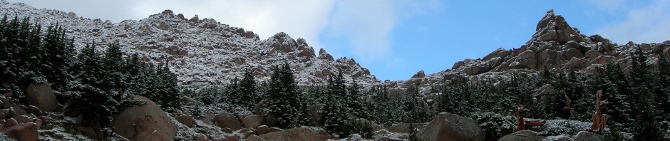
A comment about the weather — it was gorgeous; blue skies no wind, a white haze over the summits to the west. We started up the trail/road on snowshoes to the Buckskin Joe Mine where we took a minor detour to explore the mine entrance and find the right road. We were blessed in this part of our approach that some backcountry skiers had been up the trail sometime in the last week and the snow under their tracks was hard ice. This allowed us to make better time through 5″ of fresh powder than it would have been through the other 36″ of old snow. We made steady linear progress around the slope but vertical progress was limited to 500′ from the car. Denise had picked Loveland and Buckskin due to the total RT mileage of 5 miles. It was clear to us now that the route description was for summer travel so we prepared ourselves for a longer day.
We broke out of tree line at about 11,400 after starting at 10,500. Again the weather – it was hot! We had no gloves on, no hats and then we stripped to our lightweight polypro tops… and this was Colorado in Jan! We were later to learn that the sun and great weather was primarily situated over our little mountain range as it was overcast and snowing throughout most of the state elsewhere. What faced us now as we gained the east ridge was a heavily snow laden bowl that showed definite signs of recent avalanche activity – can’t go that way. This is where our trip became a bit longer. The only way we saw free of avalanche danger was to go further south and come up for the southeast side of the ridge. I felt like we were walking around this mountain, not going up! We stopped to explore a huge snow mushroom that had built up behind some trees. It was about 30′ long and 15′ high and was an interesting thing to explore until we heard this “wump” and retreated.
We were sweating like the proverbial pigs as we finally started to ascend the mountain. We made steady progress gaining the lower part of the ridge by a rock outcropping. My feet in my plastic boots were plenty warm as we joked that we could have climbed this mountain in sandals it was so warm. Once up on the wide ridge we could see forever, and it was all up. The view was fabulous with Silverheels to the NE, 3 14er’s (Lincoln, Bross, and Democrat to the Northwest, and the Mosquito Pass area to the south. We also saw a herd of big horn sheep higher on the mountain. We were to follow them all day coming and going, adding to our enjoyment of being outside. Many false summits on the ridge and aerobic minutes later, we finally reached the summit of Loveland where a rather large cairn is placed. We looked at our options for Buckskin which was still a mile away via the continuing ridge. The weather was still good, although the white haze hung over Buckskins summit. Our 5 mile RT for two summits had turned into an 8 mile RT for Loveland only so we decided that would make a much better summer ascent. We sat down and had lunch on the summit in perfect weather. We had made the summit in 3.5 hours and Denise estimated 2 hours for the return. We had definitely decided to take the NE ridge down and avoid retracing our lengthy trek around the mountain.
Denise shot a compass heading and off we went. A slight detour around a 2,000′ drop (compass’ can’t figure out everything) and we headed down the ridge seeing our sheep friends the entire way. At the end of the ridge we were much closer to the Buckskin Joe Mine where we had started but it was a clear 1,000′ below us and the steep tree covered slope I knew hid 4-5′ of snow, that even on snowshoes we would be floundering. Denise, the skier, mused about the possibilities had she had her skis. There was about 500 yards of open snow from where we were standing on the ridge to tree line so we made a quick descent noting some signs of fracturing in the snow. Once down in the trees, we snow shoed in the “down” direction to intersect our trail coming up which we did after a bit. From there it was a shuffle (literally) down our hard packed trail to the car, arriving at exactly six hours after we had started. Heading back to Colorado Springs we encountered heavy clouds and snow all the way back. Quite a change from the little pocket of warm temps and sunny skies we had the advantage of hiking in throughout the day.
Beta: Loveland Mtn , 13,692″, near Alma, CO, East Ridge Approach from Buckskin Joe Mine, 8 Miles RT, six hours