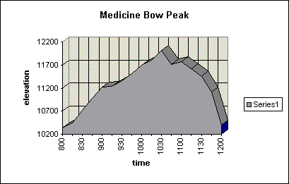
“Here, have another M&M; we need to keep moving”, I shouted to Ben, my 13 year old son Ben… while keeping an eye to the clouds working their way across the broad expanse of plains to our west. We were descending from the summit of Medicine Bow Peak at about 10:45am into the ever increasing wind…
Usually a 30mph+ wind is nothing but a nuisance but with temps in the 30’s above 11,000 we were right on our limit for what our light sweatshirts and windbreakers could safely handle. We were on our annual family vacation traveling to see friends in Colorado, Wyoming and Kansas and as such had lots of stuff packed in the van and I had purposely packed light on our hiking/mountaineering gear. Because of this, it did not need to get much colder or windy before we would be in some discomfort.
We had started the morning driving over from Cheyenne, WY beginning at about 6:00am. We stopped in Laramie for gas and a quick stop for McDonald’s breakfast and then we headed up into the Snowy Range Mountains to the pass. I had picked Medicine Bow Peak after talking with Brian Rachford, (rachford@uwyo.edu) who has climbed the peak in all seasons living so close in Laramie. Brian and I have corresponded over the Internet for years but have never met. The closest we got was a day in 1994 when we were both climbing the same peak and saw each other from a distance. We had not known it was the other until trading emails a few days later. I told him I was going to be out west in Aug and asked him if Medicine Bow peak might be a good one peak to climb with my son.
Ben was too young when I was climbing furiously in Colorado from 93-95 so this would be his first “big” peak above timberline. He had hiked longer trails in the Smokies but this would be his first time at altitude and above timberline.
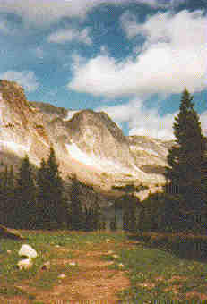
As we wound our way to the pass we debated which way to climb the peak as Brian had given us two options; cross country from near the pass or the established trail up the west side of the peak. Although longer, the trail was described as a great day hike. We chose the trail as when we topped out at the pass the entire mountain was draped with dark, angry morning clouds. We parked and started up the trail at about 8:00am, gaining altitude quickly up the initial steep portion.
I was delighted to find the trail well-constructed and graded well with switchbacks. We gained the first ridge and headed up to a steeper broken rock section where the trail continued to amaze me for its good quality. We were in the wind now and donned out windbreakers over sweatshirts/long underwear, pausing occasionally for water. Ben was hanging in there great; he just needed to get used to regulating his breathing at altitude. The clouds began breaking up over the ridge as we ascended and it was clear blue skies to the west.
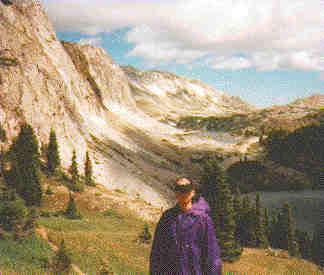
Did I mention I liked this trail? I cannot say too much about this wonderful trail. It continued up the ridge, skirting the sub peaks to the west, and cutting a swatch through beautiful alpine meadows with wildflowers galore from all of the rain the west has had recently. I kept checking Ben’s status and he said he was doing fine so we kept moving. After the 2nd false summit we started around a 3rd following the trail past a cabin foundation near the eastern cliffs. The trail is marked with the best cairns I had encountered in the west (massive stone towers with a sharpened 5-inch log in the center) so even on a foggy day you could probably climb the peak with no route finding difficulties.
This last highpoint on the ridge looked like the summit, as there were a couple of tall poles on the ridge. Ben was tired of walking “around” the peaks as opposed to climbing up so he said “let’s try it.” 15 minutes of rock scrambling later we topped out to see another higher sub peak about ¼ mile farther down the ridge. We set off down the north side of what he had just climbed picked up the trail again …. Around the 4th false summit we went and began a traverse toward the ridge crest. As we rounded that point we saw the real summit, across a broad plateau rising up to a short 150’ rock cap marking the summit. Ben and I trekked across the tundra and looked over the east side. I saw a couple of excellent snow couloirs to climb on another trip and he led the way up the final rock step.
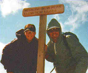
We checked out the summit cairn, the USGS marker, and what looked like a new summit sign. We rested for about 15 minutes and took some pictures. I was really proud of Ben and his display of mental and physical toughness. Ben led the way down from the summit and we picked up the trail and decided not to retrace our steps over that bump! Instead, the trail wound around to the west, dropping lower than I would have liked, causing us to climb some lost elevation. But with a great trail like this, I could not complain. Back on the ridge now, we were still at 11,000’ and had about 1 ¾ miles to hike back to where the trail dropped sharply to the lakes below near the trailhead.
This is when the clouds started to back up in the west and turn a bit darker. We were now walking against the wind and it was taking its toll on Ben to a certain degree. I tore open the some peanut M&M’s and popped a couple in his mouth… they were frozen. I repeated this a couple of times as we headed south down the ridge. We kept trudging; the clouds stayed at bay and we finally reach the southern part of the ridge where some scrub pine trees and the trail dropped down to 10,600’. Ben took the lead and took us to the top of the trail switchbacks into the warm sun and no wind. We stripped off our jackets and sweatshirts and got back to the car right at noon. Ben was tired and dozed on the way back to Cheyenne. We could now look back up to the peak and see the entire ridge. We were glad we had not seen the entire ridge before we started, as it is quite impressive and long
This was our first western summit together and it was one of those great father – son moments! My thanks to Brian for his beta and recommendation on medicine Bow Peak – I would recommend it to anyone as the one of the prettiest and well-constructed trail up a mountain.
Beta: West Marie Lake parking area, 7.2 miles RT, 1600’ elevation gain, 4 hours RT, lots of false summits and high alpine walking; great trail, Class 2.


