I look over from the passing lane and see the Harley driver smiling back as he is getting hit with bugs in the face at 75 mph… he is happy, I am happy, and Ben, my son, is happy after just knocking off 4 state highpoints in three days. We were on the homeward leg of a 2035 mile trip with 35 hours of ignition time. Along the way we had reached the highpoints of Illinois, Wisconsin, Michigan, and Minnesota.
Ben and I have been talking about this trip for about a year. We knew this would be an ideal time before we moved from Illinois (just outside of St Louis, MO) in a few weeks. Now, with the move just weeks away and Ben’s JR high graduation behind us, he and I plotted our strategy. We would make the grand circle from the south by traveling north to the IL HP, then up to MI. Then we would head west, make the dogleg turn north at Duluth to get the MN HP, then just head south and to home.
An early departure from home found Ben sleeping in the back of the van while I was concentrating on not sleeping. By daybreak I was turning on to Rt. 84 along the Mississippi River near Moline, IL. The river cuts a much narrower swath here and the homes along the bank are quite nice. At one point, there is a small bridge over the river and after confirming with Ben he has never been in Iowa; we cross the river just to say he has been there. Stopping for a quick breakfast biscuit, we head to Charles Mound, (1,235’), the highpoint, following the directions in Don Holmes’ book. We arrive at the country lane go all of the way to the farmhouse to ask permission. Once in the yard however, there is a professional looking sign that says to park your car on the driveway and walk up the hill to the highpoint.
After a very short walk up onto the ridge we get to the top of Charles Mound at 9:30am the HP signed, has two lawn chairs, and a register box. Ben signs us in and we soak in the views from this quaint HP. It would be our favorite of the four on this trip. After some pictures we head back down the hill to the van and head north into Wisconsin heading east on Rt. 11

Charles Mound!

Signing the register
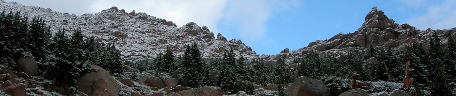
We encounter a detour so we just head north on Rt. 78 to Madison and over on to I 90 north. Wisconsin is a long north – south state and it takes us to midafternoon to reach Tomahawk, WI where we head west on Rt. 86. We need to travel about 27 miles to reach Timms Hill (1,951’) At about 18 miles we have another detour that takes us north, west, then south and actually drops us off west of the HP. Unfortunately, the closed road is between us and the HP that is now east (we made a big box around the HP due to the detour). Had we ignored the detour (and I did debate this) we would have reached the HP 1 mile before the construction started. Frustrated and a bit tired, we pull into a country grocery store to see what the options are… the owner is very friendly with a thick northern WI accent. She says we can make it if we go slow cuz the workers are not working on the weekend.
So we start down non-existent road with four miles of dirt between the highpoint and us. At one point, we encounter some mud and start to bog down but the front wheel drive pulls us through. I stop and reconsider as a family out for a walk with their dog comes into view. I stop but they say I have come through the worst so I keep heading east and 3 miles later emerge to the pavement again. We locate the highpoint, making one minor wrong turn and head up the one way road into this small county park.

The biggest wooden tower I have seen… The WI view!

The biggest wooden tower I have seen… The WI view!
Unfortunately the Anderson’s are having their family reunion and have parked everywhere alongside the road. When there is finally an opening to creep by, I gun it and get to the main parking lot, pulling on the side of the road. Ben and I head directly up the nicely wooded trail and within minutes we are on top where the largest wooden lookout tower we have ever seen looms above. We scamper to the top at 3:00pm and take some pictures of the very nice views above the tree canopy. Then it’s down the hill to escape the Anderson family reunion, headed east on Rt. 86 now because we know it is open to Tomahawk.
When I first planned this trip I did not try to determine exact stopping locations and we had brought a tent and enough camping gear to stay anywhere. By 5:00pm, we were both tired of driving after doing some 700 miles so we stopped in Rhinelander, WI for the night. I felt this was close enough to posture for success at the MI HP and maybe even the MN HP the following day. After wolfing down some Chinese dinner, Ben and I retired to the hot tub and to bed. This high pointing is tough work! After staying the night in Rhinelander we felt we were in the great north. There were snowmobile trails everywhere, hockey was the sport, and ice fishing was not too far behind. I think it gets cold up here in the winter! If you ever get to Rhinelander, make sure you figure out what a Hodag is…it will bug you until you do!
We are on the road by 0630 and travel into the Upper Peninsula of MI, which is beautiful. A crisp 40-degree morning with frost on the car windows led to a beautiful sunrise as we dodged the many deer alongside the road heading north on RT 45 and east on Rt. 28 to L’Anse, MI. Although mainly flat, the Upper Peninsula has more pine and fir trees than I have ever seen, even in the west. There were great places to have a home site around every turn and a lake around every bend. Every car had a boat or a camper in tow. I have since decided that the Upper Peninsula and the North Shore of MN are the best kept secrets in the United States. Obviously if you get a chance and have done been there before, I would suggest a visit!

Snowmobiles are the most prevalent mode of transportation!
By 8:45am we are in L’Anse and headed east following both Holmes’ map and David Wickersham excellent directions.
Michigan was only highpoint on this trip that I was concerned about locating as it had a history of people getting lost finding it in a forested area with too many trails to count. As I started on the approach gravel road (and let me mention about the back roads in MI and MN – I have never traveled such flat, well maintained gravel forest service roads anywhere!) Ben was navigating by reading the instructions and mileage while comparing them with the map. We found the right road, found the gravel pit, found the bridge (anyone who has done this HP can relate) and started to see signs for the MI HP. At this point we continued down the roads following the signs until we (in our van) could go no farther. At this point, we parked the van by a pond and started up the logging road on foot, following both the directions and the signs at turns and branches. In short, you cannot get lost. After about 1.5 miles of hiking in the morning coolness we arrived on “top”, the treed summit of Mt Arvon, (1,979’) complete with a marker and register. While Ben signed the register, I took pictures and began swatting mosquitoes.

Mt Arvon!

Time to change for the road again
As we started to walk down the trail, my watch registered 10:00am. After getting back to the van, we changed into shorts and sandals (the only people within 200 miles dressed like that I assure you), we headed back out down the 8 miles of gravel roads. I suggest Ben drive since he turns 14 in a few days so we switched and Ben did an admirable job in navigating the twist and turns of the road with only an occasional “center Ben!!!” comment from me. We switched drivers at the wide open gravel pit after he got it up to 40 mph. We headed back to L’Anse where we picked up a morning rain shower as we viewed Lake Superior from the town shoreline.

Water Fall
Retracing our steps we headed west now on Rt. 28 stopping at a beautiful waterfall where we scrambled up a 40-foot wall to climb to the fall’s source. The drive across Northern MI and WI was great. We followed the Great North Trail, a very long rail to trails project that was for snowmobiles and cross-country skiing in winter to horses and bikes in the summer. It must have followed us west for at least 100 miles.
We stopped for lunch at McDonald’s in Ironwood, WI on Rt. 2 and when I asked if they had any beanie babies they said they were out but the store in Ashland did have them. Ashland…? I asked where that was, east or west and she said west so off we went toward Duluth. Stopping at the Ashland McDonald we drove up to the window where I asked, “Do you have any teeny weenies?” When she got done laughing, she handed me “Pinchers”, the crab and a bag of cookies for $1.99. I explained I was not a professional beanie hunter but that my daughter and more importantly, my wife had asked me to at least ask the question.
We reached Duluth by 3:00 pm but the turnoff at Lutzen is still a long way – some 90 miles as described by Donald Desrosiers, a fellow high pointer in his trip report. It was at this point Ben and I started the debate on whether to attempt to reach Eagle Mountain’s summit today or wait until first thing in the morning. We had watched the sunset last night and noted it did not get really dark until 10:00pm being this far north so we half decided to continue north and give it a shot. Ben loaded up my Mountainsmith lumber pack with the first aid kit, water, food, and everything we night need just in case something went wrong and we had to spend the night. As we continued up the coast of Lake Superior, we continued the debate. Ben felt strong and even though it had been a long day we decided to go for it…. Just then a heavy shower passed overhead. The weather ever since we had started had been unseasonably cool and partly cloudy with an occasional shower. Today was no different.
We turned left at CR 4 at Lutzen (quicker than coming from the north) and it quickly turned to another great gravel road. Ben changed into his long pants while I kept going – 16 miles in total. You just have to have faith you are on the right road as there is not a sign for Eagle Mountain until about 14 miles. All the while you are heading into more and more of a wilderness area in Superior National Forest. When we had quite a ways with no signs I saw a truck headed towards me and I flashed my lights to get him to stop. I asked him if we were headed in the right direction and he said to just turn right in another mile to the trailhead and it was clearly marked. He also said there was a moose on the right after the turn!
Ben had just been telling me that besides countless deer, he wanted to see a wolverine! How about a moose I asked him as I sped off!? In a mile we saw the right hand turn sign for Eagle Mountain. We slowed down and Ben thought he saw something black in a clearing. As I was backing up, Ben spotted the moose tracks (very large tracks) down the side of the road. When I got back to the clearing there was the moose, about 100 yards away standing by a small pond (one of the 10,000 in MN). The moose was very large and black in color. Continuing on, we found the trailhead in short order on the left and pulled into the gravel lot at 5:45pm. Stripping off our shorts, we put on long pants, hiking boots, and Gore-Tex shells as a light rain was falling. The mosquitoes appeared immediate, but we found if we kept moving, they would not alight and bite (too much).

Starting the hike at 6pm with Ben leading…

1 mile in you enter the designated wilderness
I was still trying to decide if this was a good idea. This was supposed to be a 6.4 round trip on a rocky trail through the Boundary Waters Canoe Wilderness area, but Don’s trip report had hinted that it might be shorter, perhaps 2.5 – 2.75 miles one way. High pointing in sometimes different than other hikes in that you may reach the highpoint in the middle of the night depending on the driving and your stamina. Ben said he felt ready to do it so we took off down the trail with Ben leading the way. Within 5 minutes we passed a couple and their two dogs (there had been one other car at the trailhead) and that was the last person we ever saw. Ben set a strong pace as we wound our way deeper into the wilderness, past lakes, over wooded bridges, and through marshland. Don said he did it in 55 minutes to the top but with our picture stops, etc. we arrived on top after about 78 minutes. The trail had been wet, rocky but easy to follow. The turnoff to the Eagle Mountain was a well signed and the abrupt climb led to some stunning views toward Canada. The only problem was we could not stop due to the mosquitoes. We read the summit marker and took some pictures pretty proud to be standing on our 4th state highpoint in 48 hours!

On the summit of Eagle Mountain

1 of 10,000 lakes in MN
Ben said I could lead down and we started back down the trail, mindful not to twist an ankle at 7:30 PM, 3 miles into the BWCAW on a Sunday evening. We made better time going back, somewhat helped by the mosquitoes getting more brazen as the sun started to set. We both started to get tired near the end as it had been a long day but we got back to the van at about 8:45pm and jumped inside opening the windows to blow the bugs out the back.
Retreating back to Rt. 61 we headed south back towards Duluth to find food and a place to put our sleeping bag; in that order. Suffice it to say we found neither on a Sunday night at 10:00pm in the great north! We ended up at Two Harbors, a lot farther than either one of us wanted to go that night. We found a place to crash and we did just that…
The next morning I awoke and try to place some order back into the contents of our van while Ben got an extra hour of sleep. After breakfast we toured Two Harbors, went out on the levee into Lake Superior before heading south to Duluth. Leaving the interstate, we dipped into downtown Duluth to do some sightseeing…nice city! It was not until about 10:30 we started south in earnest heading back down into Wisconsin on Rt. 53 toward Eau Claire. This is when we started seeing the Harley Davidson drivers all headed toward Milwaukee for the 95th Anniversary of Harley Davidson. They were everywhere on all types of bikes! I had more than just a passing interested as I had just completed the Motorcycle Safety Course and was considering buying my own motorcycle.
It took most of the day to get down through Wisconsin and we finally reached the Illinois state line about 4:00pm. The weather continued to be threatening until finally the row of thunder storms from the west made it undesirable to stop and camp. Ben voted to continue to head south as we could be home by 9:30pm. We did and made it easily, driving through rain shower pockets all of the way home.
It had been a lot of driving in a short time, but we had upped our highpoint totals to 19 for me and 8 for Ben. Along the way, it’s great bonding time between a father and a teenage son. Better yet, we had done it while living in the area just before our move. Now we can tackle all of the state highpoints in the northeast next summer and winter on a road trip we are already planning. I just wonder if I could do them quicker on a Honda Pacific Coast….?