Descending to the Summit …
Usually I hike UP to the summits, but this plan had been hatched earlier in the winter when the thought of hiking UP through deep snow from a low trailhead was simply too much to bear.
The plan called for DRIVING up to the Devil’s Playground parking area on Pikes Peak at about 12,900’ and taking in the short “jaunt” over to Sentinel Point. Well, the road never opened that high on our dates of availability and then one weekend I looked it up in my mapping software and was surprised to find it was 2.63 miles from the parking area, all over 12,000’. Since hikers can never travel like the crow files I suspect the round trip distance is closer to 7 miles. … “Not a jaunt”.
Finally yesterday everything came together…the road was going to be open, the weather was clear, and Don and I were available. After 32 emails, we agreed on the objective.
Once the plan was announced, Ray committed to hiking UP from the Craig’s trailhead close to his home and meeting us at the saddle on the ridge to Sentinel Point. Chuck and his wife decided to reconnoiter the route also and started out behind Don and me by about 1 hour.
Don and I met at the Pikes Peak Highway at 0900 and got in line behind the fisherman and occasional tourist. The ranger said the road was open 15 miles, about one mile above Glen Cove, but a mile short of where we needed to park.
As we drove UP past Glen Cove, Don decided he wanted to explore the Elk Park trailhead and made a sharp left onto a small gravel road off of a blind curve. It looked like we were going straight OFF the mountain! OK, I was awake now, no more coffee needed! After deciding we would come back on another day to hike this area we continued UP the road and ran into two rangers blocking the road. We stopped and chatted and soon they allowed us to pass to continue UP to the Devil’s Playground so we could start our “training hike.”
We got started about 15 minutes later and struck out across the open area to the trail DOWN to the saddle area where we would meet Ray. Two separate parties of two climbers heading UP to the summit passed us as we headed DOWN.
I am not sure what time we actually started, but we had taken our sweet time to reach this point. However, Don must have been timing Ray’s arrival to the minute as we reached the saddle at the approximately the same time. So to put this in perspective, Ray had been hiking UP for at least two hours at this point and we had been hiking DOWN about 20 minutes.
This time and effort difference in retrospect seems fair as Ray appears to have super human hiking abilities. I had mentioned to Don driving UP that sometime we ought to actually hike WITH Ray from the start and Don replied, “No, we do not want to do that….” Previously, we had tried to meet on the top of Raspberry Mountain and well…with the snow and a wrong summit, well, that’s a different story.
Chuck and his wife were still going UP in their SUV to the parking area as we reached the saddle, keeping us informed via HAM radio. If this is starting to get complicated and you feel you need a scorecard to keep track of who is coming UP and DOWN, let me summarize. Don, Ray and I are now at a low saddle on Pike’s Peak at about 12, 500’ and ready to start up the ridge toward Sentinel point as Chuck and his wife Gwen, arrive at the parking lot to follow us on the ridge.
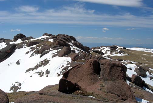
Ray explains that we cannot see Sentinel Point until we go UP the ridge and over the false summit, which we promptly tackle. Once on top, we can see Sentinel Point in the distance and note it is still a “a ways” Down the other side before the ridge narrows, Don and I stash our snowshoes under a large rock and mark a waypoint in the GPS. Across a rocky ridge, Ray executes a Sylvester Stallone jump for a short gap, and I follow, along with Don and Molly (super dog). We continue on in sunny windless conditions one minute and strong wind the other. We put on our shells for the last 1.5 miles to the base of Sentinel Point across an open wind scoured broad ridge.
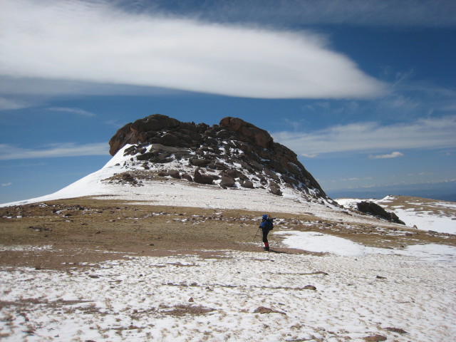
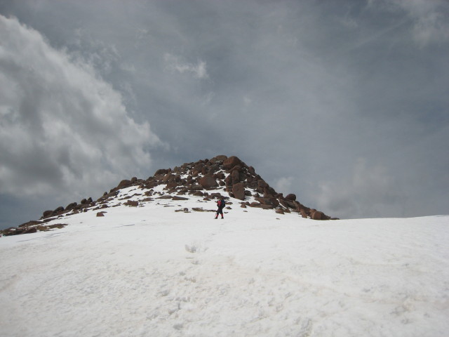
Sentinel Point rises sharply up steep snow slopes to a rocky summit. Ray and I strip off our jackets as the sun is intense and we know the last 500’ is going to be hot. I head UP the slope, kicking steps and using my ice axe, preferring to go straight up rather than switch backing. We gain the rocks about 100’ from the summit and pick our way upward, partly on rock and partly on snow.
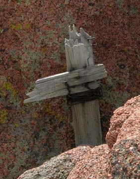
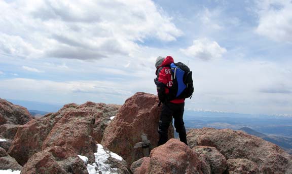
Finally we climb over the last rock outcropping and reach the actual summit, a small collection of huge rocks where the survey marker and a homemade wooden cross mark the spot.
Within 3 minutes of reaching the top, clouds move in, the wind picks ups, and it grows colder…timing is everything. Don and Molly join us and we grab a quick bite and try to vector Chuck in our location. He has reached our snow shoes stash location and then retreated back up to the first false high point on the ridge to see if he could see us on Sentinel Point. Don flashes his signal mirror and compass direction headings flash across the amateur radio bands. I concentrate on my piece of BBQ chicken cold pizza, giving some of the best parts to Molly.
The signal mirror does work with Ray’s wife who is at their house in the valley below and she sees the flash through her binoculars.
This leads me to the conclusion that people (little black dots from a distance) are hard to see in the wilderness and hikers should always have a signal device with them in case they become hurt or lost. Their chances of survival will go UP if they have a signal device.
After 10 minutes on the summit with clouds thickening, I announce I am leaving… Don just laughs. He is beginning to note I am notorious for not staying long on summits… mainly due to lightening, weather, from past experiences.
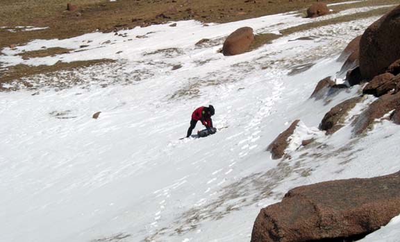
I do note that the return trip for Don and I is all UP hill while Ray’s route takes him DOWN! J We descend from the summit, picking our way down through the rocks. Once in open snow, I try a 50’ glissade attempt. Ray and Don walk by on their feet noting with some disdain me sitting in the snow. But a 50’ glissade is 50’ saved walking!
Ray stays with us across the broad expanse of the ridge as we hike UP toward the narrow part of the ridge. He then takes a “left” and angles across a huge snow field that seems to go on forever where he will intersect the gully down to the Craig’s trailhead from west, saving about a mile. He is just a dot in the snowfield and makes a radio call before he descends from his ridge and once at the bottom to indicate he is safe and continuing DOWN. Don and I continue UP, negotiating the narrow ridge in the gathering wind and around the false summit. We skirt the south side of this point on steep snow and up and around a small cornice back to the ridge where we retrieve our snow shoes.
Now we only have a bit more than a mile back to the car, up and over yet another highpoint and then the long slog up the trail UP to the Devil’s Playground. We are passed by back country skiers and snow boarders headed DOWN to ski the chutes above Glen Cove. Chuck and Gwen had retreated from the ridge earlier in hopes of waiting for us at Glen Cove cabin. That thought did not survive other thoughts of a sandwich café in Woodland Park and even though they were with us all day via radio, we never actually saw each other yesterday. Is that a virtual climb?
Don drove down the mountain without any further sudden departures from the main road and we were both home probably before Ray hit his house. We learned later, that Ray had completed his BIG hike safely.
This has been one of the more complicated trip reports I have written for a day hike but again, I have never hiked DOWN to a summit, never met two other parties enroute (one virtually) and never had to climb all the way back UP to a trailhead.
It seemed like a good idea in January….
Beta: Approx. 7miles RT, 5 hours Elevation gain/loss:


