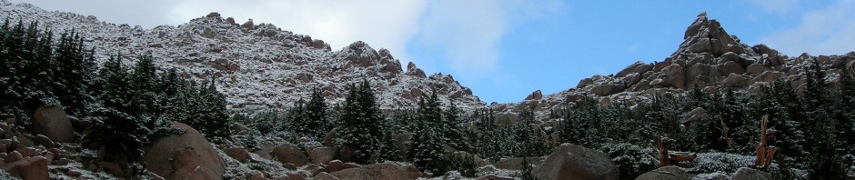

Our route
“KEEP RIT”… Steve’s motto and what his license plate reads as we sped along at a high rate of speed on I-5 north to Shasta from the Bay area on Sunday afternoon….
Steve and I met via the Internet in November 1996 when I was fishing for information on a Jan 97 winter climb of Lassen Peak. We debated whether Lake Helen was on Shasta or Lassen… it’s on both, but I do not count it as a lake!
We did meet during that Jan visit, but heavy California rains, floods and mud slides closed the road to the Lassen Park and Rt. 50 to South Lake Tahoe. We deferred to the Desolation Wilderness via a circuitous route north of the lake. Although we enjoyed winter snowshoe and camp out, it left us hungry for a real challenge.
In April 97, I found I was headed back to the Bay area on business in July so we set our sights on Mt Shasta; Steve’s favorite mountain. Steve picked me up from the San Francisco airport and we arrived in Shasta about 6:00pm. We checked into the Strawberry Inn (highly recommended) where Steve had been a regular visitor while training for the climb in the preceding months. We retired to the garden patio for wine and cheese, while evaluating the next days’ route high on Shasta.
Certainly not the toughest bivy I have been on, but I began to like Steve’s idea that if you are going to climb trailhead to summit in one day you might as well get a good night’s sleep. Most people camp at Horse Camp or Lake Helen which effectively shortens your summit day. What I did not like about the facts that we discussed on the patio was that we would be starting from 6,800’ and ascending 7,300’ (vertical gain) to the summit. Having just arrived from Illinois that day (elevation 300’) I was a bit apprehensive since I had not been high since Nov 96 in Mexico. I started on Diamox 2 days prior to climbing as I was going from Day 1 (300’), Day 2 (sleep at 3,500), to summit at 14,162’, not the ideal scenario in any case.
We woke at 3:30am and dressed, packed, and headed up the short 20 minute drive to the trailhead at Bunny Flat. We loaded up and headed up the trail with our headlamps on. Steve set a rapid pace and within 500 yards not only was I out of breath, my legs felt like wood, and my morale was plummeting. I had relied on road cycling to prepare for this climb and had not carried a pack since Jan. I struggled behind him, feeling clumsy and disjointed… and I am the guy that loves to climb at night!
That first 1100’ elevation gain brings you to the cabins at Horse Camp at tree line. Steve had been making his training climbs in 33-35 minutes to this point and we arrived in 40 minutes. That is a pretty good clip at any measure and I was not feeling good at all, and thinking about calling it quits.
As we paused at Horse Camp I topped off my water bottles bottles at this beautiful spring. We met some folks just waking up from their tents around the cabin… one gent named Ben was from Atlanta and he looked to start out right behind us. We chatted for a few moments before starting out on the Oberman Causeway. The “causeway” is a line of massive rocks through the alpine tundra that you hike on to preserve the fragile ground. It is named after the guy who started the project some years ago and is quite unique. I know some 14er’s in Colorado that would benefit from a like project!
It was just starting to get light as we broke clear of tree line, still on the causeway. The causeway gives way to a scree trail as we hit the first steep part above the trees. I then started to get into a rhythm and life started to get better… I was finally feeling some good karma.
The sun was starting to etch its tentacles up the mountain, but we were still climbing in shadows, but only in our light weight poly pro. As we approached the first snow field we did not initially put our crampons on as the slope was gentle up to Lake Helen—which is not really even a lake at all. It is more or less a berm on a slope that probably once held water, but now just contained 3-4 tents dug into the deep snow. I went ahead past the berm to stop and out on my crampons and swap my trekking poles for my ice axe. Steve stopped at the berm to get his gear on and have an energy bar. The cramponing was good; the snow had frozen from the night before… and up we went toward the “heart”. There were about 7 people above us (or as Steve referred to them – competitors) and 9 below us. All had started at Lake Helen or Horse Camp and we were the only ones who had begun the climb at Bunny Flat.
The slope from Lake Helen continues to steepen toward the “heart”, about 900 vertical feet below Thumb Rock at the Red Banks. Above the Heart, the snow field steepens to about 42 degrees. We caught the first group of two midway up the slope and a 2nd group of three climbers near the Heart. The slope was quite icy but careful cramponing made for good progress. A fall here would be a “bad thing.” We chose an exit couloir straight up to the left of Thumb Rock, making for a more direct but steep exit to the ridge.
We gained the ridge after a little bit of delicate ice work near the top and rested and ate some food while perched atop the Red Banks overhanging the Konwakiton glacier. Some clothing changes and equipment adjustments and we were off. We did not see the Atlanta climber after that and think that he may have turned around.
We were soon headed up the ridge above Red Banks to the bottom of Misery Hill. Since Steve had mentally prepared me, I knew there were a couple of false summits and it did not phase me. I was feeling better with each step, knowing we were at about 12,500’ already, approaching 13,000’. We went straight up Misery Hill (is there any other way?) to the narrow ridge that we traversed about 20’ below the crest high above the Wintum Glacier. The snow was beginning to soften and placement of crampons became important. The ridge ended on a broad plateau below the summit pyramid. Steve started running in front of me for about 150 feet and later explained to me that this was his climbing tradition to show the mtn he still had some left for it. I just kept walking on the snow field to the base of the summit pyramid.
The true summit of Shasta is quite spectacular, depending on snow conditions, being a rock buttress with the last 100’ up and around leading to a simple scramble to the top. Just as we arrived, a gent in the first summit group proposed to his finance and she accepted. We took their pictures and them ours….
It had taken us 6 hours and 18 minutes to reach the summit from the trailhead. We sat down out of the wind and ate some food and rested in perfect weather conditions. I did place on my shell jacket and wind pants for the trip down. I was actually sort of surprised I felt great—I could eat, drink and relax at 14,000’ after living at 300’ up to the day before. But all good things come to an end and I never linger on summits anyway, even in good weather, so we started down, looking to glissade the steep parts, thereby saving our legs. In about 20 minutes we were down above the Red Banks, after passing about 7 people on their way up.
I took off my crampons at Red Banks for the 2,000’ glissade. It was the deepest, curved, glissade track I had ever gone down and it was great fun. Steve called it an “E Ticket” ride. We could not let it all hang out as it was somewhat icy, but in 15 minutes we were back at Lake Helen. We kept going until we were at the edge of the last snow field, before we took a lunch break. I stripped down to shorts and a t-shirt and dried out my clothes. I did make a cell phone call to Illinois to tell my wife I was down (almost) and Steve left a message for his wife. The descent back down the causeway went quickly and soon we were at Horse Camp.
Steve stopped to talk to Robert Webb, the caretaker, who had recently set a record of climbing Mt Shasta 5 times in 24 hours. He also holds the speed record from Horse Camp (8,000’) to the summit at 99 minutes. After a short break we hiked out the last miles to the trailhead down the hot dusty trail. Along the way we saw the results from last year’s avalanche that roared down the drainage. We were both looking at a 100’ pine tree bent over near the ground when we heard a loud crack and it fell to the ground. Well, that answers that age old question (When a tree falls in the woods, does it make a noise when there is no one there to see it?)
Reaching the car we were tired but happy climbers; our first summit together as partners. I was really impressed with the mountain – its varied climbing terrain, beauty, and challenge make its great climb on any day (weather permitting). It was my 1st 14er in California and 40th overall in the United States, so I was very pleased. More importantly I had found a great partner in Steve and as we complimented each other’s strengths and weakness throughout the climb… I had found another great partner via the Internet! All that was left was the high speed drive back to the Bay area… hoping everyone on the road would “KEEP RIT”!

The data
Beta: Mt Shasta, 14,162’, 7300’ elevation gain, 6 hrs 18 minutes to summit, 10 hrs RT, about 13 miles RT.